


To expedite exploration activities in the country, Geological Survey of India (GSI), has embarked upon an ambitious scheme to complete some major National level surveys by 2024: National Geochemical Mapping (NGCM), National Geophysical Mapping (NGPM), National Aero Geophysical Mapping Program (NAGMP). GSI is also going to adopt sophisticated deep penetration geophysical techniques such as Magneto-Telluric Surveys and Deep Seismic Reflection Surveys (DSRS) in order to define the crustal architecture for deep seated mineral targeting.
GSI has also initiated its flagship initiative of National Geoscience Data Repository (NGDR) for collation of all the geoscience data of the country involving GSI, other national organizations with geoscience as a focused activities, all the state directorate of mines and geology, the academia engaged in research and development in the domain, the CPSEs engaged in exploration and geoscientific pursuits, and private sector agencies working in the domain. It aims at integrating the collected data by GSI and the similar organizations to build a repository on the digital medium entailing multiple user access. It is planned that all the stakeholders from India and across the globe who are willing to participate in the current auction regime for allocation of mineral acreages will be able to use the NGDR. Further, the planned Baseline Geoscience Data Collection campaign would also lead to a huge database, which will be the primary inputs for future exploration programs. GSI is in consultation with BISAG-N, a national institute under Ministry of Information & Technology for development of NGDR.
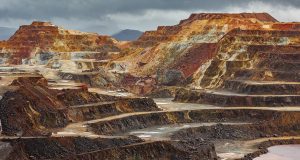
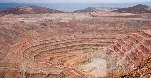
NGCM: GSI envisages completion of NGCM programme by 2024 by extensive outsourcing and engaging private agencies. A total of 11.72 lakh sq.km has been completed by NGCM Programme till March 2020. This also involves coverage of 7.44 lakh sq.km of accessible part of Obvious Geological potential’ (OGP) (8.13 lakh sq.km). It is an all India programme to cover the entire surface area of the country by geochemical sampling. The NGCM work will generate distribution pattern of 62 elements (samples collected at 1km x 1km grid) for use in managing and developing natural resources; for application in environmental, agricultural, human health, other social concerns and to search for hidden mineral deposits.
NGPM: The Program have been systematically generating basic and derived maps of Bouguer (Gravity) Anomaly and IGRF corrected magnetic total field maps of the country by conducting ground gravity and magnetic surveys in 1: 50,000 scale with an approximate observation density of one station in 2.5 sq. Km., to cover the entire country with preference to Obvious Geological Province (OGP) areas. The anomaly maps derived from the processed gravity and magnetic data provides all stakeholders a framework to design exploration strategies.
NAGMP: First of its kind project in the country, its objectives are to delineate concealed, deep seated structure/ litho-units capable of hosting mineralization, delineate extension of the existing mineralized zone and understating of shallow crustal architecture in the context of mineral occurrence. The first phase of work involved collection of data over selected areas (12 Blocks) of Obvious Geological Potential (OGP). As of now, data acquisition over first four blocks (Blocks 1 to 4) is completed which resulted in carving out of more than 100 potential mineral exploration areas. Owing to the success of the project, 10 more blocks (Blocks 13 to 22) are to be covered by multi sensor aero geophysical mapping. It is for the first time that the multi-sensor aero-geophysical surveys (magnetic gradiometry and spectrometric) are being carried out by adopting such large regional scale survey parameters of 300 m traverse line spacing with aircraft flown at 80 m above ground level.
Significance of these Programmes:
The collation, assimilation and integration of the data generated from the above projects and further interpretation will lead to identification of more areas for mineral exploration in the country. The increased investment in mineral exploration will build a robust pipeline of prospective mineral blocks for auction. This will ensure long-term viability and continuity of mining in the country taking India towards the cherished goal of ‘Atmanirbhar Bharat’.
Out of the total mappable area of 3.146 million sq. km of the country, 3.119 million sq. km has been covered by Systematic Geological Mapping on 1:50,000 scale till December 2020, which accounts for approx. 99.14% coverage of the country. The data generated through this mapping activity has helped to build up the knowledge database for National Geo-scientific information, which helps in boosting mineral exploration activities, and other earth science related socio-economic activities and programmes. During the last decade, GSI has prioritized baseline data generation over Obvious Geological Potential(OGP) areas, which accounts for approx. 0.813 million sq. km